How to Inventory Your Property’s Natural Resources: Free DIY Methods
Discover what is really hiding on your land. A foolproof, step-by-step guide to conducting a free natural resource inventory using free apps and simple mapping tools.
How to Inventory Your Property’s Natural Resources: Free DIY Methods
When you purchase a new property, the deed tells you the property lines, and the tax assessor tells you the acreage. But neither document tells you what you actually own. They don't tell you the health of the soil in the back forty, where the seasonal springs emerge, or the species composition of your mature timber.
If you don't know exactly what you have, you cannot make intelligent management decisions. You might accidentally plant a high-value apple orchard on poorly drained clay, or unknowingly bulldoze a rare native wildflower glade to build a shed.
Conducting a Natural Resource Inventory (NRI) is the absolute first step in land management. Hiring an ecological consulting firm to do this can cost thousands of dollars. However, using modern free digital tools and some sweat equity, you can conduct a highly accurate DIY inventory of your 10 to 100 acres in a single weekend. Here is how.
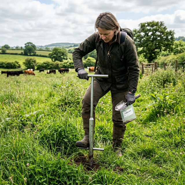
1. The Foundation: Soil and Topography
Everything on your land is dictated by the soil and the shape of the earth. You can gather this data before you ever walk out the back door using the greatest free tool available to landowners: The USDA Web Soil Survey.
Generating Your Custom Soil Map
- Go to the NRCS Web Soil Survey website.
- Use the address or interactive map to zoom in on your property and draw an "Area of Interest" (AOI) polygon around your boundary lines.
- Click the "Soil Map" tab. The tool will instantly generate a highly detailed map overlay showing exactly where different soil types (e.g., sandy loam, heavy clay) exist on your land.
- Click "Soil Data Explorer" to generate custom reports. The site will calculate the exact agricultural yield potential, timber growth index, and drainage classification for every inch of your land. Print this out.
Grabbing Topo Data
Use Google Earth Pro (the free desktop application, not the web version) or mapping apps like OnX Hunt to lay a topographic contour map over your property line. This will instantly reveal hidden drainages, steep slopes, and flat plateaus that dictate where water will pool or run off.
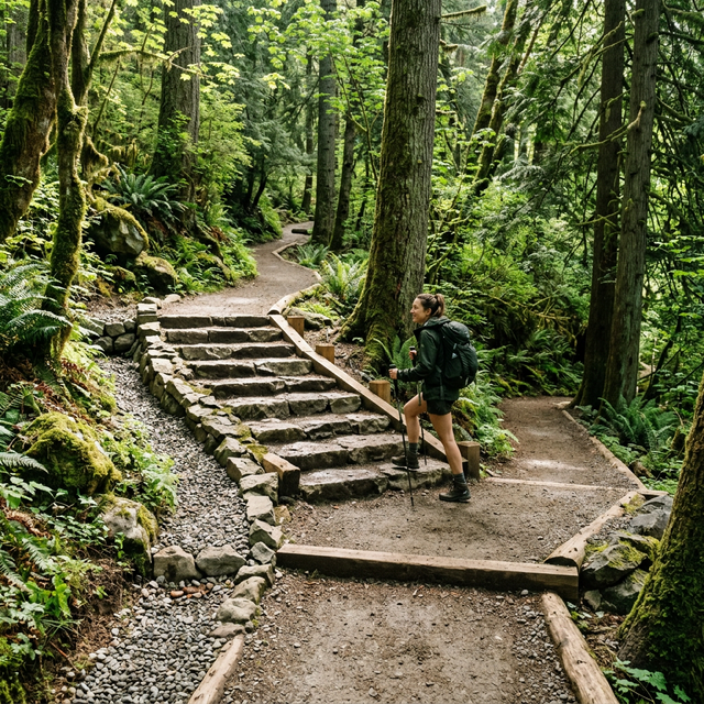
2. In the Field: The "Timber & Flora Walk"
With your soil map and topo map printed on a clipboard, it's time to physically walk the land.
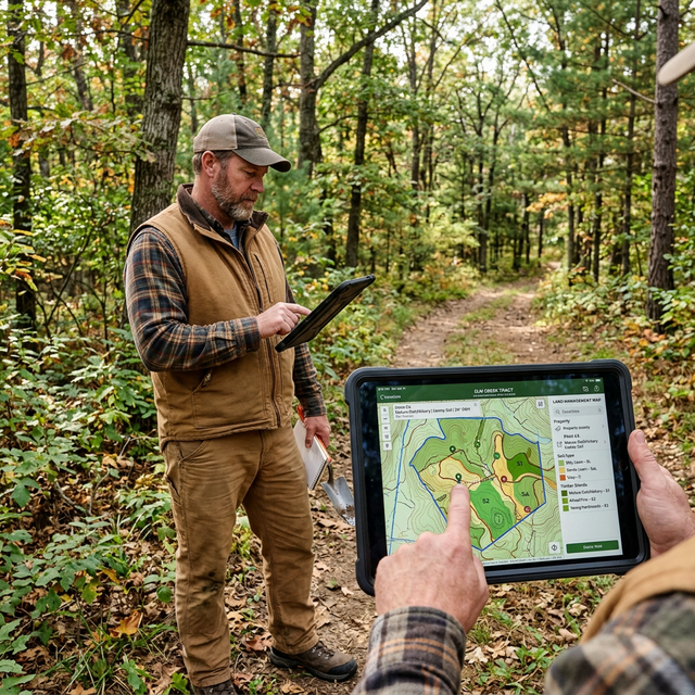
Mapping the "Stands"
Don't try to catalog every single tree. Instead, use a map app on your smartphone (like Google Maps or Avenza Maps) to drop pins and divide your woods into "Stands"—areas of similar age and species.
- Example: "Stand 1: 10 Acres - Mature White Oak and Hickory on a South-facing ridge."
- Example: "Stand 2: 5 Acres - Dense, young Pine thicket in the old pasture bottom."
Utilizing Plant Identification Apps
If you cannot tell an elm from an ash, technology is your best friend. In 2026, free apps like Seek by iNaturalist or PictureThis use incredibly accurate AI to identify plants from a single photo of a leaf or bark.
- As you walk, intentionally scan the understory. Take photos to identify the low-growing shrubs.
- Crucial Step: Explicitly look for and mark the location of invasive species like Autumn Olive, Multiflora Rose, or Japanese Knotweed on your map. Early detection defines your eradication strategy.
3. Water Resources and Hydrology
Water is life, but it also dictates where you cannot build or plant.
- Walk the property in the rain (or immediately after a heavy storm). This is the only way to accurately map ephemeral (temporary) streams and vernal pools.
- Mark on your map where water consistently pools (these are excellent sites for future pond development or wetland restoration).
- Mark areas of deep erosion or "head-cutting" in gullies. These are your emergency priority zones for NRCS conservation funding (like EQIP).
4. Wildlife Habitat Assessment
Look for the "messy" areas; these are your wildlife strongholds.
- Snags & Dens: Drop a pin on your map every time you find a massive, dead standing tree (a snag), a hollow log, or a groundhog burrow. These are critical nesting sites.
- Hard Mast: Mark the locations of massive, old-growth oaks or hickories. These "wolf trees" produce the acorns and nuts that drive the entire winter food chain.
- Edge Habitat: Note the condition of the transitions between your woods and your fields. Are they abrupt, or feathered? (See our guide on Managing Edge Habitat).
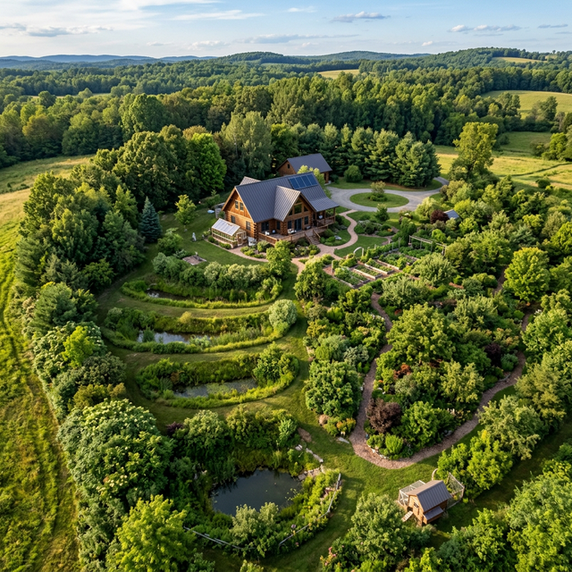
5. Summary and Next Steps
A Natural Resource Inventory transforms your property from a "patch of woods" into a distinct, measurable series of ecological zones. By layering USDA soil data with physical field observations of timber stands, hydrology, and wildlife signs, you gain the granular data required to write a successful 5-year management plan.
Action Steps:
- Tonight, log onto the USDA Web Soil Survey, define your property boundary, and generate your free custom soil report.
- Download a plant identification app to your smartphone and practice using it in your backyard.
- Schedule a 4-hour block this weekend to physically walk your property borders and interior trails with a clipboard, dropping GPS pins to define your distinct timber stands.
Once your inventory is complete, use that data to shape your long-term goals by reading our guide on Creating a Simple 5-Year Land Management Plan.
Sources & Further Reading
- USDA NRCS Web Soil Survey: websoilsurvey.nrcs.usda.gov
- iNaturalist / Seek App: inaturalist.org
- Penn State Extension - Assessing Your Forest Resources: extension.psu.edu
- MyLandPlan.org (American Forest Foundation) - Mapping and Goal Setting Tools: mylandplan.org
Written by Dr. Sarah Mitchell, Senior Editor & Land Management Specialist at LandHelp.info. Dr. Mitchell strongly advocates for citizen-science and empowers landowners to take active, data-driven control of their conservation efforts.
Tags:
Dr. Sarah Mitchell
Senior Editor & Land Management Specialist
Dr. Mitchell has over 20 years of experience in natural resource management, with expertise in sustainable agriculture and forest stewardship. She holds a Ph.D. in Natural Resource Management from Colorado State University and has worked with the USDA NRCS for 15 years.